

Yarra Track (Yarra Glen-Healesville section)
Location
Healesville (area) VIC - Property No R71630, R71741
 Show Place Maps and Streetview
Statement of Significance
The Yarra Track is probably of State, as well as regional significance, as a major early transport route that shaped settlement patterns along its route and was critical to the economy of the isolated mining settlements it served. The physical evidence that remains includes surviving features and current road alignments that follow the route of the track.
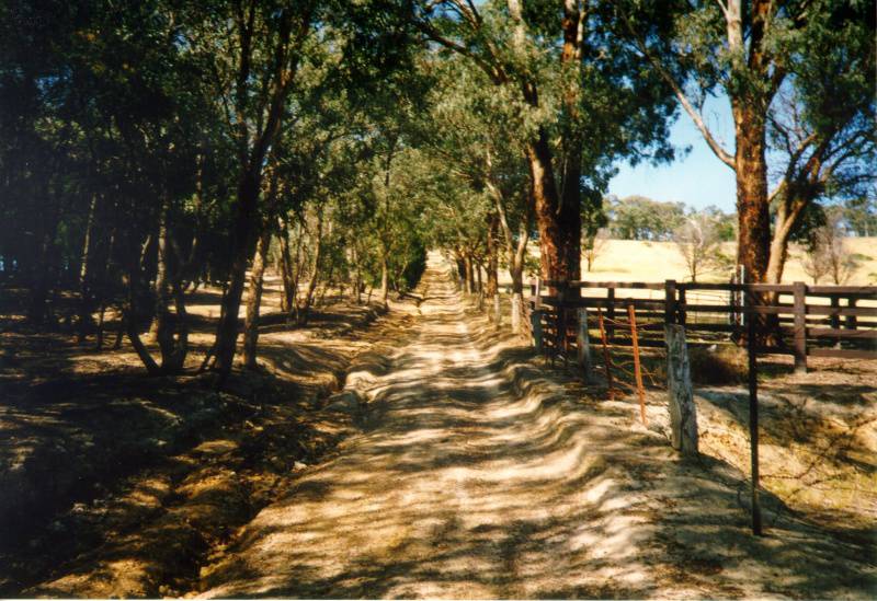
Description
The Yarra Track is associated with the Woods Point gold diggings in the 1860s. There are a number of sections - many outside the Yarra Ranges Shire. Some well known sections within the Shire are the Old Healesville Road, Breakneck Road and the former Hit or Miss Bridge.
The section of the original route of the Yarra Track known as Breakneck Road was viewed from its Yarra Glen end. It runs from Skyline Road in the Christmas Hills down the ridge to where it joins up with King Street in Yarra Glen. The road travelling east down from the ridge into Yarra Glen, is a very steep and eroded dirt track and was unable to be accessed due to its steep and poor condition. Gently winding, it passes cleared grazing land and remnant and regrowth bush, including eucalypts and casuarinas, before crossing the Maroondah Aqueduct. Once in the valley, the road is sealed and joins up with King Street. This track is known as The Breakneck and also Ryries Track.
The second portion of the Yarra Track surveyed is a sealed road in excellent condition known as the Old Healesville Road. It extends for around eight kilometres from its departure from the Melba Highway out of Yarra Glen to where it joins the Healesville-Yarra Glen Road around five kilometres west of Healesville. Travelling from Yarra Glen, the double-lane sealed road passes grazing areas with homesteads, haystacks, crops and some fields of vines. There are plantings or regrowth along the fencelines of properties. The road commands excellent views of the valley, including the undulating hills and the foothills of the distant ranges which frame the view. It enables access to the Yarra Track Winery and is part of a network of routes to enable visitors to explore the wineries of the region.
There are additional sections of the Yarra Track which were not inspected during the present study. Historic sites along the track have been identified by Peter Evans (1999) but occur in sections of the track east of the surveyed area. A number of the hotel sites along the Track are separately listed in the database for this study. The Hit or Miss Bridge (now demolished) was identified by the community submissions. It was located on Yarra Glen Road at Donovan's Lane.
Physical Conditions: Varies
Integrity: Evidence of stages