
Mt Dandenong Observatory
Location
26 Observatory Road, Mt Dandenong VIC 3767 - Property No 21216
 Show Place Maps and Streetview
Statement of Significance
Mt. Dandenong Observatory Reserve, which now includes Sky High Restaurant and the TV Towers, has regional significance as an important landmark for the whole of metropolitan Melbourne. The site has historical significance as a place which has attracted tourists for over a century drawn by the superb views of the surrounding countryside. The site has particular historical significance as the highest peak in the Dandenong Ranges, marked in the 1860s as a survey point for the Victorian Geodetic Survey, and now by the Sky High Restaurant and TV Towers. Observatory Road, constructed in 1930 for motor traffic and made a public highway in 1935, has significance for its associations with the tourist boom years of the 1920s and 1930s.
Description
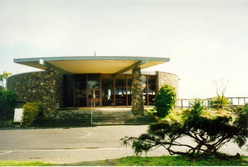
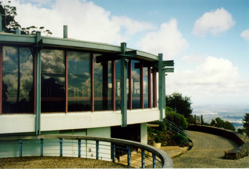
The Mt Dandeong Observatory comprises a complex of features, designed around the Sky High restaurant, and based on concentric and overlapping circles. At the centre, the Sky High building is the focal point. It is a circular stone clad structure with a flat roof and dramatic portico. Large picture windows allow views to Melbourne. It is a strong built element, using a simple form that is then repeated and reflected in the surrounding external landscaping.
There are extensive external viewing areas on the west side of the building, each a semi-circular concrete platform enclosed by a steel balustrade. To the west and east are extensive car parks, the most popular being that on the west side where both day and night viewing of Melbourne occurs.
These built elements are enclosed within an exotic and native garden, some sections of which include plants with strong architectural forms.
Physical Conditions: Good
Integrity: Evidence of stages