
Monbulk Homestead
Location
Ryans Rd (Nixon's Road, or Monbulk Creek Road), Lysterfield VIC 3156 - Property No S03535
 Show Place Maps and Streetview
Statement of Significance
The remains of the old Monbulk Homestead have high local significance for their associations with the Dargan family, early district pastoral pioneers, who acquired the Monbulk run in 1850. The Monbulk Pre-Emptive Right property is of significance as one of a large number of such properties in Yarra Ranges Shire. The property has historical significance, too, for its associations with the Nixons and Brandts, prominent district families.
Description
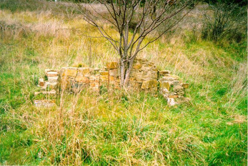
Extensive evidence of the Monbulk homestead survives within the northern part of Lysterfield Park. It is located on a north-facing slope above Monbulk Creek. The site is bisected by Dargon Track.
The site of the homestead is marked by the ruins of the fireplace (or perhaps kitchen hearth). It is a stone and brick structure. Nearby area extensive heaps of bricks and other building rubble, much covered in blackberry and other weeds. Adjacent to this is a small cutting. Presumably the rubble has resulted from the demolition of the house. Nearby is a flat area that may have once contained a building, and another larger area to the east that also appears disturbed.
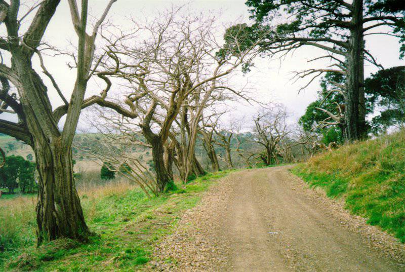
Extensive plantings survive near the homestead including two large pines, a Norfolk Island Pine, a cypress, a windbreak of Robinia(?), and an orchard area. There also appear to be some other conifers some distance away from the homestead site that may form part of a cultural landscape.
While the evidence remaining is quite fragmentary, the plantings create a distinctive cultural landscape, and careful site recording is likely to reveal more extensive evidence than was noted in this field survey.
Physical Conditions: Fair
Integrity: Minor Modifications