| Back to search results » | Back to search page » |
|
Ziebell's Stone Cottage & Barn - Westgarthtown Group
Other NameZiebell's Farm Location100 Gardenia Road,, THOMASTOWN VIC 3074 - Property No B2312
File NumberB2312LevelState |
|


Statement of Significance
Cottage Classified: 'Local' 25/06/1969
Revised: 'Regional' 15/02/1973
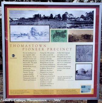
Statement of Significance for Westgarthtown Group: A portion of the original 640 acres bounded on the east by Mount View Road, on the south by Pioneer Court and the Main Street Reserve, on the west by a line west of and parallel with Gardenia Road (to take in 127 Gardenia Road and by Balmain Court, and on the north by a line east from the head of Balmain Court) to the angle of Kalara Close, and thence to Mount View Road, and being part of the original square mile.
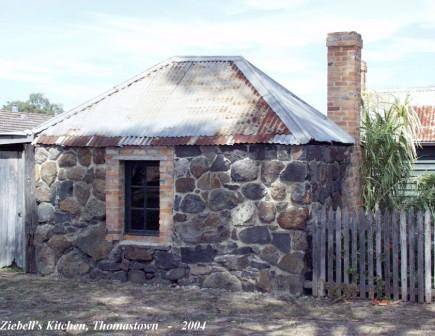
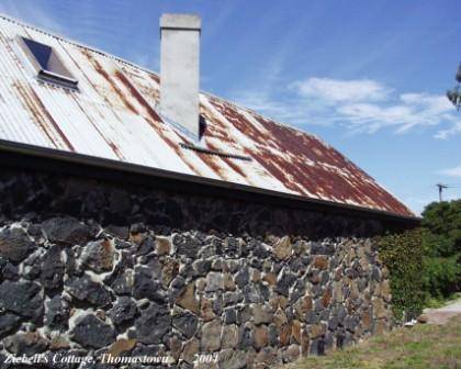
The surviving elements of one of Victoria's most distinctive ethnic settlements, reflecting the historical circumstances of settlement, German vernacular building traditions, and the geology and conditions of the area.
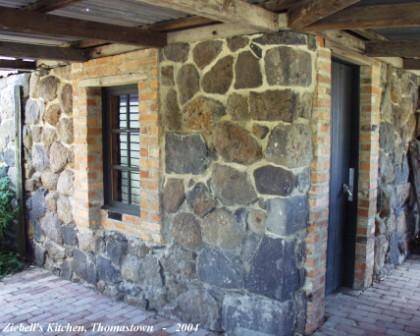
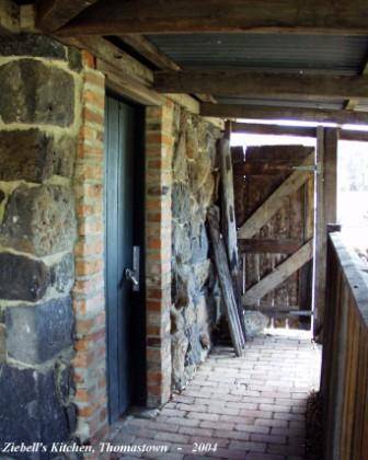
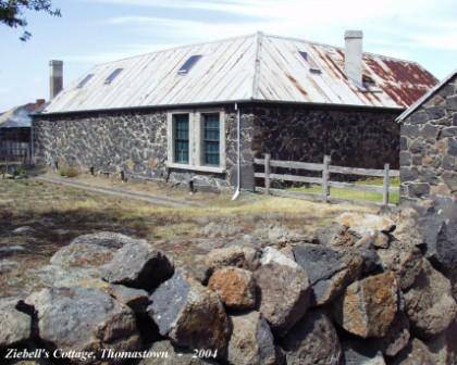
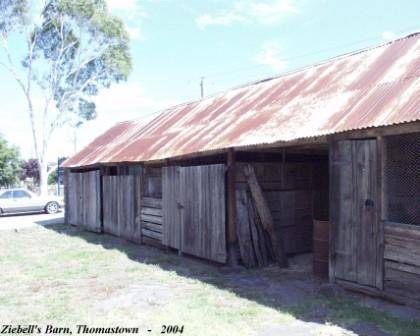
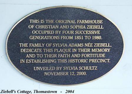
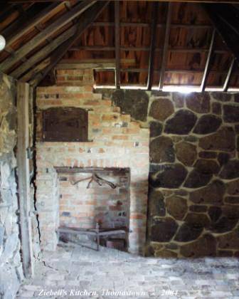
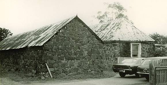
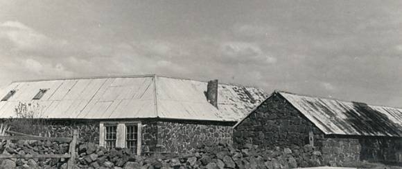
The settlement dates from 1850 , when a square mile of land was bought by the Melbourne merchant and historian William Westgarth on behalf of the immigrant German settlers. The surviving elements date principally from 1856 to 1873, and are now scattered through a sprawl of post-1950s suburban development. These elements comprise the cemetery and the Lutheran Church of 1856, both on Rosedale Drive; Ziebell's farmhouse and outbuildings at 100 Gardenia Road; Maltzahn's farmhouse at 127 Gardenia Road (now drastically defaced), Wuchatsch's farmhouse and outbuildings at 74 Robert Street; Siebel's house of 1860 at 77 Mount View Road, and Graff's barn and house of 1877 at 1 Thomas Street. The houses, excepting Siebel's, tend to take the form of a single row of interconnecting rooms without corridors, and the roof forms vary, with the characteristic Saxon jerkin-head appearing on Wuchatsch's house and Graff's house and barn (the dormers of Graff's house being modern). They were built in local basalt in forms varying from the almost cyclopean rubble wall of split grey and red-brown floaters on the west face of the Ziebell house, through the largely squared bluestone of the Graff barn, in which upper faces are dressed back to snugly accommodate the irregular bases of overlying stones, in the true cyclopean tradition; to the largely squared but partially irregular courses of the Siebel house; to the common squared coursed rubble of the Ziebell outbuildings.
Group Classified: 'State' 07/03/1985
See also: B2306 Lutheran Church; B3962 Siebel's Farmhouse; B3966 Wuchatsch's Farmhouse; B3041 Graff's Farmhouse, B3061 Maltzahn's & B5597 Westgarthtown Group.
Group
Farming and Grazing
Category
Barn