| Back to search results » | Back to search page » |
|
Mount Misery Creek Bridge
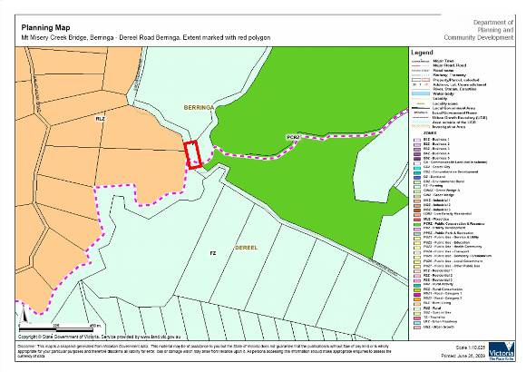
LocationBerringa - Dereel Road BERRINGA, GOLDEN PLAINS SHIRE LevelIncluded in Heritage Overlay |
|


Statement of Significance
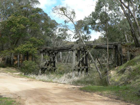
What is significant? The Mount Misery Creek Bridge is located on the Berringa - Dereel Road in the Enfield State Park. It was constructed in 1906 to provide permanent access to the township of Berringa and to facilitate the transportation of gold extracted from the Berringa Goldfields. The Mount Misery Creek Bridge is situated on a crown land road reserve and defines the south-western boundary of the Enfield State Park. It is 2.5 kms south of the township of Berringa. The Mount Misery Creek Bridge is an early but conventional example of a timber trestle road bridge, designed by Grenville Shire Council engineer Mr. Martin. The bridge was officially opened on 30th August 1906 by Miss Montgomery, daughter of the first Grenville Shire Engineer. This type of bridge became very common when it was adopted as a standard design by the Country Roads Board from the early 1920s. How is it significant? The Mount Misery Creek Bridge is of historical, architectural (engineering) and aesthetic significance to the Golden Plains Shire. Why is it significant? The Mount Misery Creek Bridge is of local historical significance as a surviving example of an early timber trestle bridge constructed to link the local mining industry to the broader trade routes of Victoria. The bridge is of local architectural (engineering) significance as a surviving example of a timber trestle bridge from the turn of the century, designed by Grenville Shire engineer Mr. Martin, adopting a form which later became standard.
The Mount Misery Creek Bridge is of local aesthetic significance for its ruinous but picturesque condition and setting over the Mount Misery Creek and its association with the surrounding bush land of the Enfield State Park.
Group
Transport - Road
Category
Road Bridge