| Back to search results » | Back to search page » |
|
Mornington Peninsula National Park
LocationVIC 3939 - Property No L10067
File NumberL10067LevelState |
|
Statement of Significance
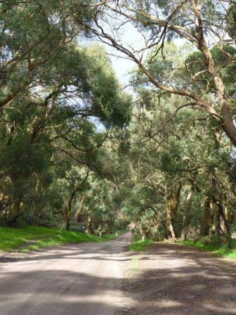
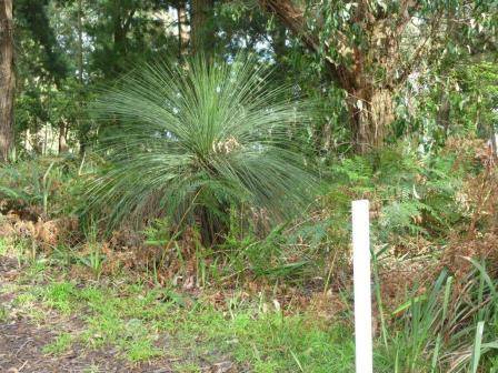
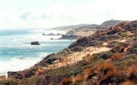
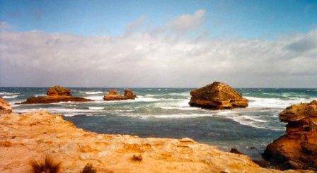
File note 31/05/2012: This classification now incorporates files L10058 (Greens Road and Greens Bush) and L10073 (Point Nepean Ocean Coastline). Greens Road and Greens Bush This area, which was first occupied by the Aboriginal people, also has connections with some of the earliest European settlement in Victoria. However because much of the land was considered unsuitable for cultivation, it has been lightly affected by European contact and today, after two decades of protection and regeneration, it presents an almost unmodified natural environment. Greens Road, the northern track into Greens Bush, is one of the oldest European documented tracks in the Peninsula hinterland. It possibly follows part of an Aboriginal path along the Peninsula's main ridge from Arthurs Seat to Cape Schanck. With verges of remnant bushland, it provides a tranquil entrance into the park. From this track visitors look over a gently sloping rural landscape to the northwest to glimpse distant panoramic views of Port Phillip, Point Nepean and Bass Strait. Walking through Greens Bush, visitors can enjoy the beauty of the changing bush landscape, from Heathy Woodland through rare Sand Heathland, carpeted with grass trees, and vulnerable Damp Sands Herb-rich Woodland to Coast Banksia Woodland. How is it significant? Why is it significant? Aesthetically and geographically significant views of Point Nepean, Port Phillip and Bass Strait may be seen from Greens Road, making it a point of orientation for walkers and National Park visitors. Within Greens Bush the views are of an almost untouched open forest landscape with vegetation showing a rich and pleasing variety of form and colour, full of the scents and sounds of the Australian bush. Historically the region of Greens Bush and Greens Road has been associated with the activities of Indigenous people, and there have been several findings of Aboriginal artefacts on the site. Settlers of European origin have farmed in the area since the 1830s, and it was included within one of the earliest squatting runs. Other early activities included grazing, and timber cutting to supply nearby lime kilns. The road through the area, surveyed in 1891, was one of the earliest on the Mornington Peninsula. The history of the public struggle to preserve this land, and the sequence of events leading to the Government purchase of land and subsequent evolution of the Greens Bush component of the Mornington Peninsula National Park is also significant. Point Nepean Ocean Coastline The Point Nepean Ocean Coastline is of State significance for the following reasons: a. Evidence of Aboriginal occupation; b. Association with the First Settlement at Sorrento (the site of the signal station), and with the developers of real-estate and early recreation resorts in the Sorrento area during the latter part of the 19th century; c. Scientific Interest relating to its geomorphology, particularly as a unique record of past landforms, and remnant coastal flora and fauna; d. Aesthetic characteristics of the rugged coastal landscape, and the superb views obtained from the many high points to both ocean and bay-side areas. LOCATION: Southern Mornington Peninsula Classified: 26/07/2008
What is significant?
The significance of Greens Bush, (now part of the Mornington Peninsula National Park, managed by Parks Victoria) and the adjacent section of Greens Road lies in the unique opportunity to experience one of the largest, most diverse areas of remnant indigenous bushland containing rare and vulnerable plants and animals on the Mornington Peninsula, combined with a location close to Melbourne and readily accessible by the public.
Greens Road, its verges and views to the northwest, and Greens Bush are significant for scientific reasons at a State level and aesthetic and historic reasons at a Regional level.
Greens Bush has scientific significance as one of the most important remnants of relatively undisturbed indigenous vegetation on the Mornington Peninsula. It includes at least 7 different EVCs (Ecological Vegetation Classifications). One of these, EVC 6: Sand Heathland is classified as rare and at least 3 EVCs are vulnerable. These are EVC 3: Damp Sands Herb-rich Woodland, EVC 136: Sedge Wetland and EVC 191: Riparian Scrub (Department of Sustainability and Environment). It contains a number of rare and threatened plants, and important populations of native fauna that have largely disappeared from other parts of the Mornington Peninsula.
Group
Landscape - Cultural
Category
Other - Landscape - Cultural


