| Back to search results » | Back to search page » |
|
Waratah Bay
LocationWARATAH BAY VIC 3959 - Property No L10252
File NumberL10252LevelState |
|
Statement of Significance
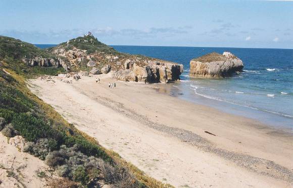
Waratah Bay has a coastline of approx. 30 miles in length. It is roughly semi-circular in shape. There are long sandy beaches backed by tea-tree scrub (Leptospernum laevigatum) and Banksia woodland (Banksia integrifolia) from Darby River to Shallow Inlet. Sandy Point township lies on the eastern side of Shallow Inlet and stretches for a mile along Waratah Bay. A sandy beach runs in an arc for approx. 6 miles to Charlie Brown's, another small cluster of holiday houses. Here the coastline changes to high cliffs of Devonian sandstone marking the course of the Waratah fault line. These cliffs are covered in bush dominated by Eucalyptus and give excellent views across the bay to Wilsons Promontory. At Walkerville the geological structure changes to limestone and there are a series of lime kilns which were worked extensively for the Melbourne trade in the last two decades of the nineteenth century. From Bird Rock past Digger Island to Bell Point the geological structure is a complicated series of four distinct limestone formations. Some of these have been mined. From Bell Point to Grinder Point the geological structure is Lower Ordovician limestone and a three mile belt of Cambrian greenstones and dolerite. These are the oldest rocks in South Gippsland. The coastline between Bell Point and Grinder Point is fringed by rock platforms. From Grinder Point to Cape Liptrap, the coastline is cliffed again in Devonian sandstones to a height of approx. 250 feet. LOCATION: Waratah Bay extends from Darby River, Wilsons Promontory National Park, northwest to Shallow Inlet and Walkerville, and then south-west to Cape Liptrap, South Gippsland. Classified: 02/12/1974
Group
Landscape - Cultural
Category
Other - Landscape - Cultural


