| Back to search results » | Back to search page » |
|
Meredith Precinct
LocationMEREDITH, Golden Plains Shire LevelIncluded in Heritage Overlay |
|
Statement of Significance
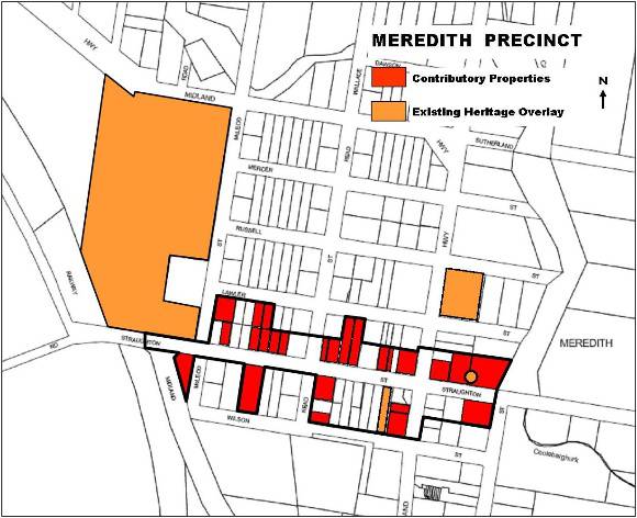
What is significant? The township of Meredith is located on the Midland Highway, an equidistant of approximately 45 km south of Ballarat and north of Geelong. It is situated on a plateau, which is generally flat, falling away to the east and north as it drops towards the Coolebarghurk Creek. It is aligned north-south to east-west, with the streets laid out in a conventional grid on either side of the Midland Highway. Meredith was surveyed in 1851/2, following the discovery of gold in the districts surrounding the township. It became an important service centre for travellers between the Ballarat goldfields and the port of Geelong. The former Meredith Police Paddock, which was the region base for the Mounted Police Troup, responsible for escorting gold found within the nearby Steiglitz goldfields, was established adjacent to the track. The Midland Highway, which runs through the centre of the township, now serves as the primary route connecting Meredith with Ballarat and Geelong. Meredith developed during the gold-rush years as a civic and commercial centre servicing mining communities as well as surrounding pastoral properties. Its prominence was reinforced by the construction of the Meredith Railway Station along the Ballarat to Geelong Railway line in 1862. A large number of stores, many of which survive, at least five hotels, of which two survive, the former Meredith Hospital, the Shire Offices, the Meredith State School and two churches survive from this period. During the post-gold rush years, the township continued to prosper as the center of a farming district that became important for its production of some of Victoria's finest Merino wool. A number of significant buildings were constructed in the early twentieth century, including the Meredith Mechanics Institute now the Meredith Memorial Hall, the Anglican Church of the Epiphany and the former Presbyterian Church, now the Uniting Church. Residential development is dispersed within the township grid and is characterised by its cottage form and scale, traditional gardens, with limited subdivision of the original allotments. The township of Meredith remains substantially intact and the surviving buildings and infrastructure from a range of periods retain a high degree of integrity. Most buildings are in good condition, for example the shops and associated residences, which survive along Staughton Street. An avenue of Ulmus procera (English Elm), interplanted with Eucalyptus specimens run the length of Staughton Street between Wallace Street and McLeod Street. How is it significant? The township of Meredith is of historical, architectural and social significance to the Golden Plains Shire. Why is it significant?
Group
Religion
Category
Church


