| Back to search results » | Back to search page » |
|
Dandenong Ranges
LocationVIC - Property No L10096
File NumberL10096LevelFile only |
|
Statement of Significance
The Dandenong Ranges rise abruptly from the plains of eastern Melbourne to a height of 640 m. at Mount Dandenong. LOCATION AND BOUNDARIES: Situated 35 km to the east of Melbourne, Victoria. This Area Classification includes the following Classified landscapes: Cotswold Valley and the following Recorded landscapes: Emerald Creek
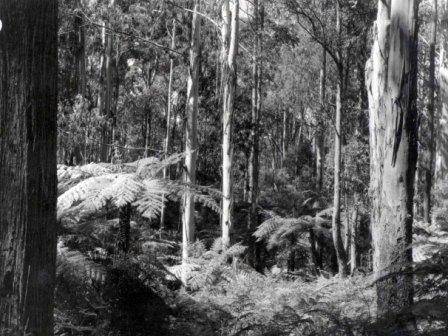
The Dandenongs have been a renowned recreation area to the east of Melbourne since approximately the turn of the twentieth century. The range possesses a variety of geological formations, landform, soils, vegetation and fauna. Intensive agriculture is still an important land use in areas such as The Patch.
There are at least 369 native flowering plant species, 150 introduced plant species and 50 species of ferns. In addition, there are numerous exotic plants, many of which are valued for the variety and interest they provide within this setting. Approximately 25 species of native mammals are known to occur in the Dandenongs and over 200 species of birds have been recorded. Numerous species of reptiles, frogs and fish also occur.
The Dandenong Ranges are one of the most important ecological, conservation and recreation areas close to Melbourne and contain landscapes of high quality and great diversity.
"Folly Farm"
The Patch
Puffing Billy Visual Corridor
Sassafras, Perrins and Ti-tree Creeks
Sherbrooke Forest
Silvan - Olinda Forest
Western Face
William Ricketts Sanctuary
Main Ridge Area
Menzies Creek Valley
Northern Slopes
Group
Landscape - Cultural
Category
Other - Landscape - Cultural


